Returns the geometry of each specified trip_id, based either on the
shapes or the stop_times file (or both).
Arguments
- gtfs
A GTFS object, as created by
read_gtfs().- trip_id
A character vector including the
trip_ids to have their geometries generated. IfNULL(the default), the function generates geometries for everytrip_idin the GTFS.- file
A character vector specifying the file from which geometries should be generated (either one of or both
shapesandstop_times). IfNULL(the default), the function attemps to generate the geometries from both files, but only raises an error if none of the files exist.- crs
The CRS of the resulting object, either as an EPSG code or as an
crsobject. Defaults to 4326 (WGS 84).- sort_sequence
A logical specifying whether to sort shapes and timetables by
shape_pt_sequenceandstop_sequence, respectively. Defaults toFALSE, otherwise spec-compliant feeds, in which shape/timetables points are already ordered byshape_pt_sequence/stop_sequence, would be penalized through longer processing times. Geometries generated from unordered sequences do not correctly depict the trip trajectories.
Details
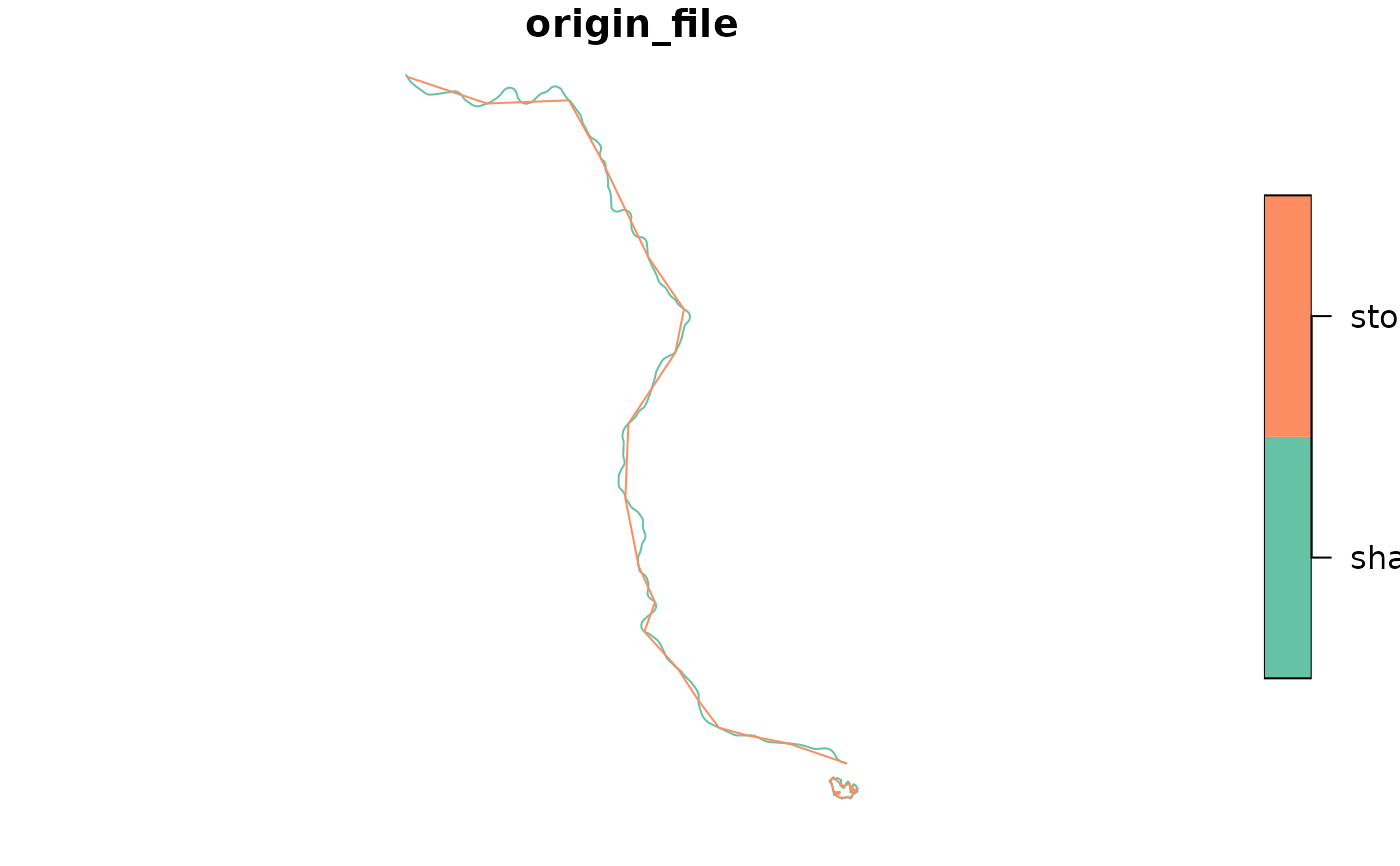
The geometry generation works differently for the two files. In the case of
shapes, the shape as described in the text file is converted to an sf
object. For stop_times the geometry is the result of linking subsequent
stops along a straight line (stops' coordinates are retrieved from the
stops file). Thus, the resolution of the geometry when generated with
shapes tends to be much higher than when created with stop_times.
Examples
data_path <- system.file("extdata/spo_gtfs.zip", package = "gtfstools")

gtfs <- read_gtfs(data_path)

trip_geometry <- get_trip_geometry(gtfs)
head(trip_geometry)
#> Simple feature collection with 6 features and 2 fields
#> Geometry type: LINESTRING
#> Dimension:     XY
#> Bounding box:  xmin: -46.98404 ymin: -23.73644 xmax: -46.63535 ymax: -23.19474
#> Geodetic CRS:  WGS 84
#>      trip_id origin_file                       geometry
#> 1 CPTM L07-0      shapes LINESTRING (-46.63535 -23.5...
#> 2 CPTM L07-1      shapes LINESTRING (-46.87255 -23.1...
#> 3 CPTM L08-0      shapes LINESTRING (-46.64073 -23.5...
#> 4 CPTM L08-1      shapes LINESTRING (-46.98404 -23.5...
#> 5 CPTM L09-0      shapes LINESTRING (-46.77604 -23.5...
#> 6 CPTM L09-1      shapes LINESTRING (-46.69711 -23.7...

# the above is identical to
trip_geometry <- get_trip_geometry(gtfs, file = c("shapes", "stop_times"))
head(trip_geometry)
#> Simple feature collection with 6 features and 2 fields
#> Geometry type: LINESTRING
#> Dimension:     XY
#> Bounding box:  xmin: -46.98404 ymin: -23.73644 xmax: -46.63535 ymax: -23.19474
#> Geodetic CRS:  WGS 84
#>      trip_id origin_file                       geometry
#> 1 CPTM L07-0      shapes LINESTRING (-46.63535 -23.5...
#> 2 CPTM L07-1      shapes LINESTRING (-46.87255 -23.1...
#> 3 CPTM L08-0      shapes LINESTRING (-46.64073 -23.5...
#> 4 CPTM L08-1      shapes LINESTRING (-46.98404 -23.5...
#> 5 CPTM L09-0      shapes LINESTRING (-46.77604 -23.5...
#> 6 CPTM L09-1      shapes LINESTRING (-46.69711 -23.7...

trip_ids <- c("CPTM L07-0", "2002-10-0")
trip_geometry <- get_trip_geometry(gtfs, trip_id = trip_ids)
trip_geometry
#> Simple feature collection with 4 features and 2 fields
#> Geometry type: LINESTRING
#> Dimension:     XY
#> Bounding box:  xmin: -46.87255 ymin: -23.55262 xmax: -46.62922 ymax: -23.19474
#> Geodetic CRS:  WGS 84
#>      trip_id origin_file                       geometry
#> 1 CPTM L07-0      shapes LINESTRING (-46.63535 -23.5...
#> 2  2002-10-0      shapes LINESTRING (-46.62963 -23.5...
#> 3 CPTM L07-0  stop_times LINESTRING (-46.63544 -23.5...
#> 4  2002-10-0  stop_times LINESTRING (-46.62962 -23.5...
plot(trip_geometry["origin_file"])